

The Simien Mountains
WFAV has built 58 improved water sources across Adiarkay and Debark woredas (municipalities) that extend into the Simien Mountains.
WFAV works in the Ethiopian Highlands in the far north of Ethiopia, primarily in the Simien Mountains and adjacent areas. We have built improved water sources through two municipalities in this mountainous region – inside and outside of the Simien Mountains National Park.
This mountain area is enormous and features high plateaus covered with alpine flora, sheer precipices that can tower 1500m high, and rocky peaks up to 4500m above sea level. In the wet season, it is lush, cool and misty but as the dry season sets in, the days are hot, the vegetation dries to a crisp and everything is coated in red dust.
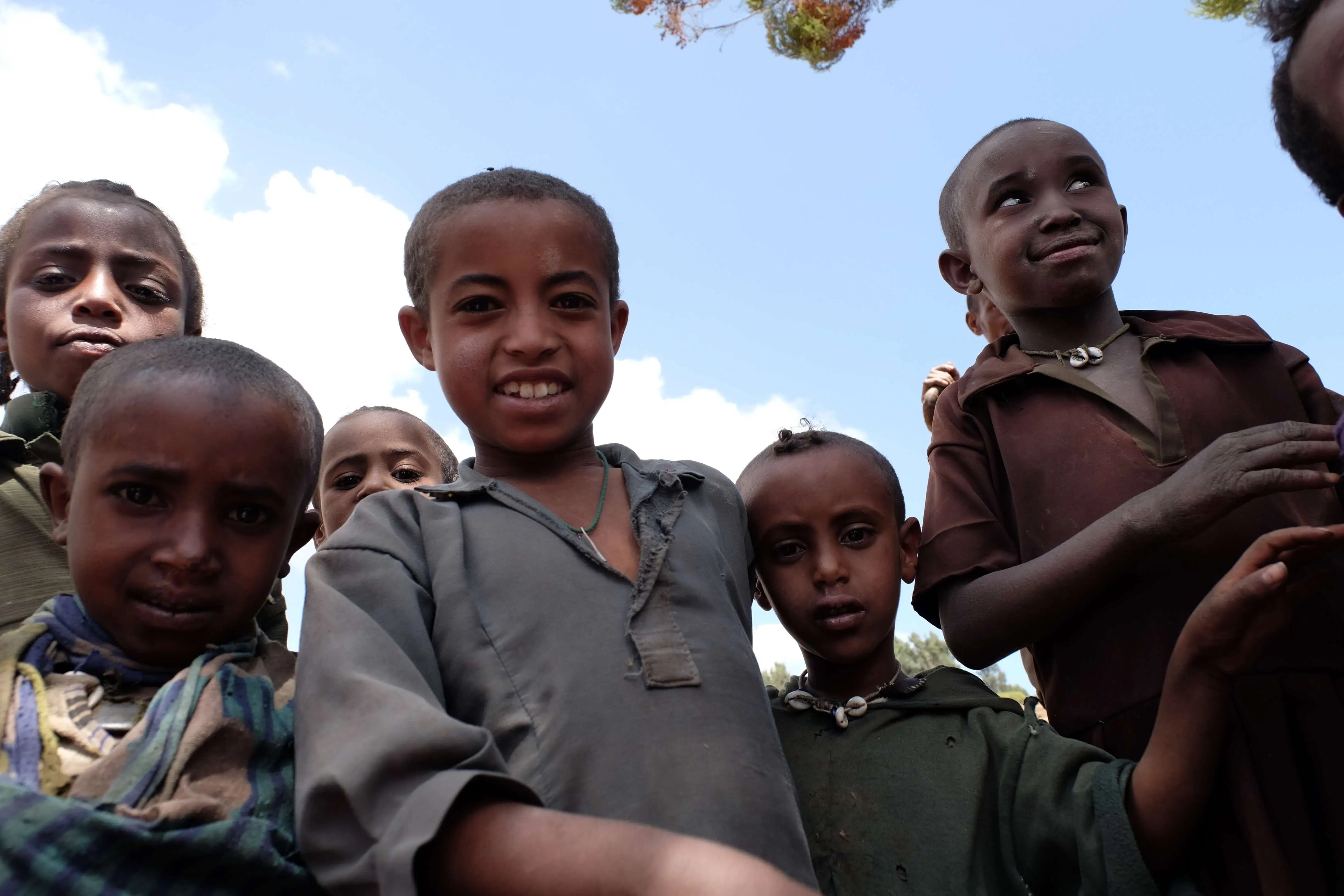
It is home to many birds of prey, jackals, huge troops of gelada baboons, klipspringers, bushbacks and the walia ibex. It is also home to many families living in isolated villages where everyone has a garden, some goats or sheep, and some land on which to grow grains such as barley or tef. Their life is largely one of subsistence grazing with little produce left to sell or trade. As the elevation increases, life becomes more challenging due to the weather, freezing overnight temperatures, the lack of clean drinking water, lack of employment, poverty, and isolation from facilities, shops, services and healthcare.

Debark
Debark is a woreda (local government area) in northern Ethiopia, located around 2850 metres above sea level. It is the closest township to the Simien Mountain National Park.
Surrounding Debark, the largest township in the region, is a series of smaller villages and towns. Catherine and Yalew have toured this region extensively, and built strong relationships with the local government. Through partnerships and engaging with local groups, Water for a Village has installed 26 water sources across the region.

Adiarkay
Adiarkay (Addi Arkay) is located on the northern slopes of the Simien Mountains. In 1999, the regional government classified its 47 most drought prone and food insecure woredas (local government areas) due to its inaccessibility and lack of basic infrastrcuture.
In 2007, a national census recorded approximately 94,000 inhabitants, although many more are likely living there, across a series of inaccessible villages. Catherine and Yalew have worked closely with the local government, partnering to install around 20 water sources across the region.
Meksagnit
Meksagnit lies south east of Gondar. Its southern border finishes at Lake Tana, home to an enormous array of wildlife including birds and hippos. Being substantially lower than the highland areas in which we have worked, the weather is milder and allows the locals to have two harvests each year of some of their crops. Because of the nature of the terrain, we generally install hand-dug wells in Meksagnit but need to be mindful that hippos sometimes emerge from the lake to feed which is a potential cause of damage.

Koladiba
Koladiba is southwest of Gondar with its southern border at Lake Tana. This is a flat area that floods dramatically during the rainy season, washing roads away and making access difficult.

Ambagiorgis
- Ambagiorgis is a sprawling town about 50 minutes’ drive to the north of Gondar where we have worked with the woreda to build two large installations. Each of them measure about 2km from start to finish and supply about 7000 people, a school and a health clinic with water. In each system, water is sequestered from enclosed springs and stored in a 24 m3 tanker. The water then flows downhill in buried plastic pipe, feeding a number of collection points on its way. This is the first time that this model has been built in the woreda.